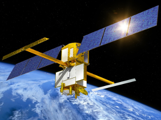
SWOT (Surface Water and Ocean Topography) is an international satellite mission aimed at studying the world`s oceans and freshwater bodies. Launched in 2022, the SWOT satellite was developed as a collaboration between NASA and the French space agency CNES (Centre National d`Etudes Spatiales). The satellite carries a Ka-band radar system that will measure ocean height with high accuracy, providing information about ocean currents, waves, and tides. The SWOT mission will also make the first global survey of the world`s lakes, rivers, and wetlands, providing important data on their extent, variability, and changes over time. This information will be critical in understanding and managing water resources, predicting floods, and mitigating the impacts of climate change. The SWOT satellite will revolutionize our understanding of the world`s oceans and freshwater systems and play a key role in advancing our knowledge of Earth`s water cycle.
 SWOT (Credit: CNES)