Global Mean Sea Level (GMSL)
The estimation of the Global Mean Sea Level (GMSL) is based on cross-calibrated multi-mission satellite alimetry. Sea level anomalies (Version 33) are used as input data. Seasonal signals remain in the time series. No glacial isostatic adjustment (GIA) was considered.
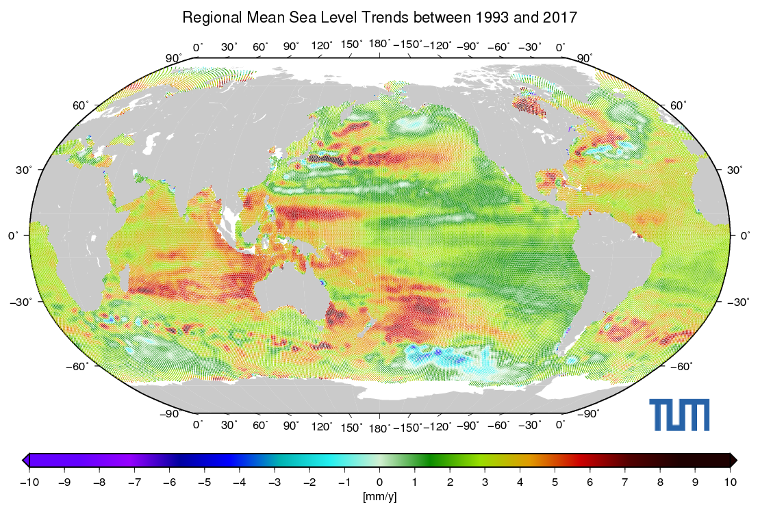
Global Trend Map
Data Access
|
Mean Sea Level
based on Sea Level Anomalies (Version 33)
|
||||||||
|
Data
| Mission | Period | Dataset | Comment | |
|---|---|---|---|---|
 |
Cryosat-2 | 2010 - 2017 | GDR (Baseline-C) | only LRM |
 |
Envisat | 2002 - 2012 | GDR v2.1 | incl. Envisat (EM) |
 |
ERS-1 | 1993 - 1996 | REAPER | incl. Phase C, Phase D, Phase E, Phase F, Phase G |
 |
ERS-2 | 1995 - 2003 | REAPER | --- |
 |
Geosat Follow-On | 2000 - 2008 | GDR | --- |
 |
Jason-1 | 2002 - 2013 | SGDR-E | incl. Jason-1 (EM) and Jason-1 (GM) |
 |
Jason-2 | 2008 - 2016 | SGDR-D | --- |
 |
Jason-3 | 2016 - 2017 | SGDR-D | --- |
 |
Saral/AltiKa | 2013 - 2016 | SGDR-T | --- |
 |
Topex/Poseidon | 1993 - 2005 | GDR-B | incl. Topex (EM) |